Tobias Research
Web Maps
Web maps related to Michele Tobias' academic research on coastal plant communities.
Interactive Mapping of Research
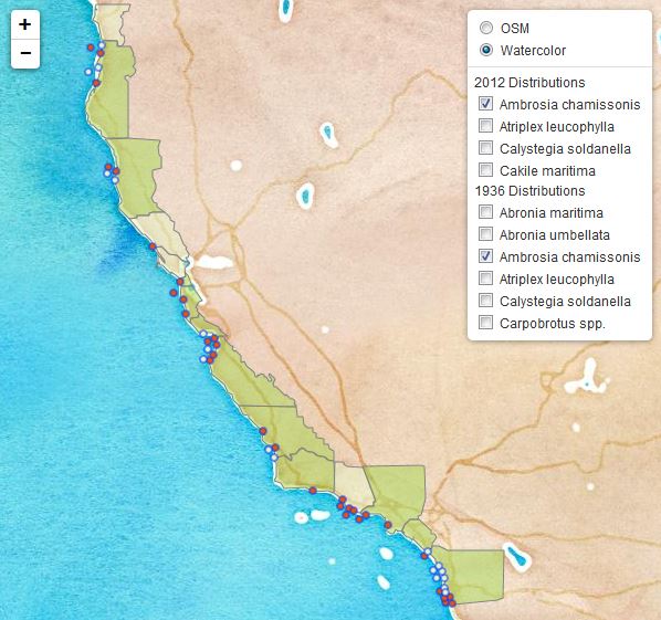
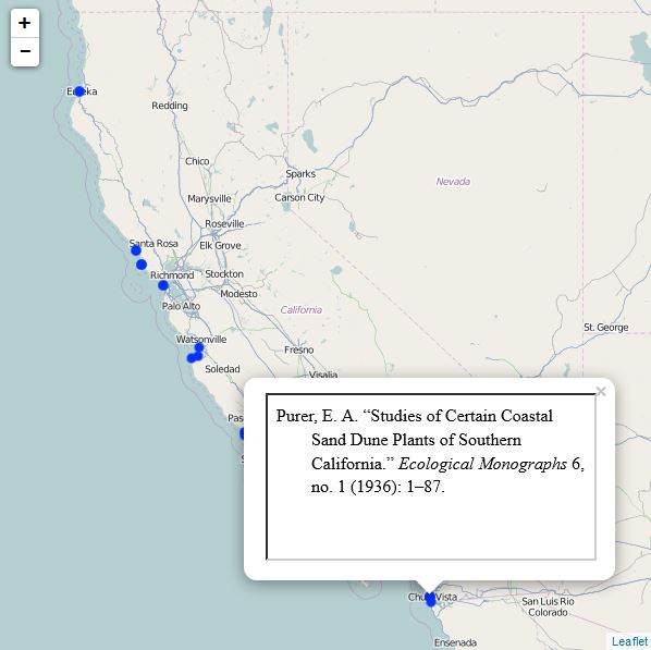
It's hard to understand a distribution until you see it on a map. In my work uncovering the ecology and biogeography of California's beach vegetation, I have found that understanding where research has been done can make a huge difference in how the findings of the research can and should be applied. So many researchers assume that information established for one study site can be applied to all areas. Research on coastal vegetation world-wide is sparse. The maps here should help us understand how the research is distributed and help identify studies that may be applied to other regions of the world.
Maps
Currently, I am working on several web maps for various purposes. One is a map that allows users to compare historic and current distributions of plant species typically found on California's beaches. This map has reached a stable point in it's development. Another shows the locations of scientific studies of beaches. This map is currently under active development.
|
|
|
Tools
 Literature Mapper is a plugin for QGIS that inserts geoJSON geometry strings into a Zotero database to facilitate the mapping of study site locations.
Cartography Collections
I make my cartographic products available on in my QGIS-Cartography-Resources Repository. The items can be downloaded from there or can be used in the Resources Sharing QGIS Plugin.
Biogeographic Research
I document my academic resarch on beach ecology, biogeography, and biogeomorphology on my Resarch Site. This site includes a list of publications (including maps), presentations, methods, tools, and equipment,
More coming soon!